One of the most persistent mistakes we encounter on DC projects is relying solely on sparse borings to model the interface between the Potomac Group formations and the overlying Quaternary alluvium. The Cretaceous-age sediments weather into a deeply irregular saprolite profile, and a ten-foot offset in refusal depth between two SPT locations can mask a buried paleochannel that will cause differential settlement under a mat foundation. Electrical resistivity fills this gap efficiently. A multi-electrode array deployed along the building footprint delivers a continuous 2D profile of the subsurface, resolving contrasts between stiff residual clays, saturated sands, and the crystalline basement rock that underlies much of Northwest Washington. Our field crews have run dipole-dipole and Schlumberger arrays across sites from the Anacostia waterfront to the high terraces of Tenleytown, and we integrate the inverted sections directly into the geotechnical baseline report so the structural engineer sees where competent bearing strata actually pinch out.
A resistivity inversion is only as good as the geological constraints fed into it — without borehole control, you are solving for an infinite number of mathematically valid but geologically absurd models.
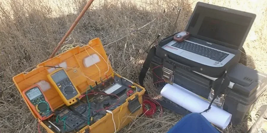
Technical details of the service in Washington DC
Risks and considerations in Washington DC
A mid-rise residential project along the Rhode Island Avenue corridor drilled six borings and logged stiff sandy clay to 20 feet across the entire site. The structural design proceeded on the assumption of uniform bearing conditions, but a resistivity survey we ran prior to pile driving revealed an arcuate low-resistivity anomaly crossing the southwest corner of the footprint. The anomaly corresponded to a buried stream channel filled with soft organic silt and peat — material that would have compressed differentially under the post-tensioned slab. The geotechnical engineer used our resistivity section to re-position three deep foundation elements and specify a bridging slab detail over the channel zone. Without the geophysical data, the settlement would have manifested as drywall cracking within the first two years of occupancy, triggering a costly forensic investigation and potential litigation under District construction defect law.
Our services
Our resistivity services in Washington DC cover the full workflow from survey design to interpretation, always calibrated against direct geotechnical data. We do not deliver raw pseudosections — every project receives a geologically constrained inversion report signed by a professional geophysicist.
2D Electrical Resistivity Tomography (ERT)
Multi-electrode profiling along linear transects to map lateral and vertical variations in stratigraphy, groundwater, and soil/rock interfaces. Common applications include foundation depth optimization, karst cavity detection in the Frederick Valley limestones, and pre-excavation characterization for cut-and-cover tunnels in the District.
Vertical Electrical Sounding (VES)
One-dimensional depth soundings using expanding Schlumberger arrays to determine layer resistivity and thickness at a single location. Particularly effective for mapping the depth to bedrock in the Piedmont province west of Rock Creek Park and for estimating the thickness of the coastal plain sediments where the crystalline basement drops off along the Fall Line.
Quick answers
What is the typical cost of an electrical resistivity survey for a building site in Washington DC?
For most commercial and residential sites within the District, a resistivity investigation ranges from US$640 to US$1,040 per day of field acquisition, with a typical project requiring one to two field days plus processing and interpretation. The final scope depends on the number of linear meters of profile, electrode spacing, terrain accessibility, and whether the survey requires lane closures or special permits from DDOT.
How does the complex geology of the Fall Line affect resistivity interpretation in DC?
Washington sits directly on the Fall Line, where the hard crystalline rocks of the Piedmont province to the west transition abruptly into the unconsolidated sediments of the Atlantic Coastal Plain to the east. This means resistivity values can change by two orders of magnitude over a few hundred meters. We calibrate every survey with at least one borehole or CPT sounding so the inversion honors known lithologic boundaries, preventing the algorithm from producing a smooth model that blurs the sharp contact between saprolite and fresh bedrock.
Can electrical resistivity detect buried utilities and USTs on Brownfield sites in the District?
Yes, and this is one of the most common requests we handle on redevelopment projects in neighborhoods like NoMa and Capitol Riverfront. Steel tanks, buried drums, and conductive leachate plumes produce distinct low-resistivity anomalies. We run high-density parallel lines on a 3-meter spacing to create a 3D block model that maps the lateral extent and approximate depth of the anomaly, which guides subsequent intrusive investigation and avoids costly surprises during excavation.
What surface conditions limit the effectiveness of a resistivity survey in an urban environment?
Asphalt, concrete pavement, and compacted aggregate base course create a high-contact-resistance layer that can degrade data quality if not addressed. Our crews use water-saturated bentonite mud caps at each electrode position on paved surfaces, and we switch to stainless steel spike electrodes in unpaved areas. Dry, frozen, or extremely coarse fill can also increase contact resistance, so we schedule resistivity work for periods when subsurface moisture conditions are favorable — typically spring and fall in the DC climate.
How long does it take to get results after a field survey?
For a standard 2D resistivity profile of 150 to 200 meters, we deliver a preliminary interpreted section within 3 to 4 business days after field acquisition. The fully documented final report, including inversion parameters, RMS error statistics, sensitivity analysis, and a geologically annotated cross-section correlated with any available boring logs, is typically submitted within 7 working days. Expedited turnaround is available for projects on tight construction schedules. More info.